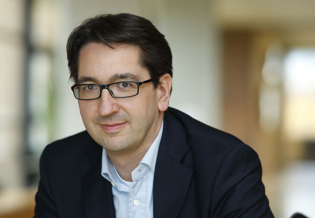
Climate researcher Joachim Curtius from the Goethe University on the effects of this record-breaking summer, their human influence, and the outlook for the future
In view of the extreme drought this summer in Germany and other countries in the northern hemisphere, many people are wondering if this phenomenon is already a consequence of human-influenced climate change, and what extreme weather episodes the future may have in store for us. Joachim Curtius is Professor for experimental research of the atmosphere at the Goethe University, and studies cloud formation, among other things. Olaf Kaltenborn conducted the following interview with him.
What makes such a long period of drought across the entire northern hemisphere possible? What factors are decisive?
That’s not a simple question. The heat waves and ongoing drought in Europe this summer, as well as in North America and East Asia, are unusual. The situation is similar to the summer of 2003 which in western and central Europe was considered record-breaking for the century or even the millennium. Following 2003, climate researchers already pointed out that summers like this would occur more frequently due to climate changes influenced by human activity and that new high temperature records were to be expected. For example, in a paper by Christoph Schär from ETH Zurich from 2004, it is predicted that extreme summers like 2003 in Europe could become the norm in the second half of the 21st century. Extreme conditions like this could even occur every second or third year, because first of all the frequency distribution as a whole is shifting to warmer temperatures, but also because the width of the distribution is becoming larger, resulting in additional increases in extreme heat episodes.
What role do jet streams play?
In meteorology, the changes in atmospheric dynamics due to climate change are being intensively investigated. Researchers want to know, for example, how the paths of low pressure systems change. Apparently, a significant part of the explanation is that “blocking high pressure systems” which are currently responsible for the ongoing hot and dry weather across Europe, are increasing, or rather, they are lasting longer. The paths of low pressure systems in the mid-latitudes are strongly influenced by the jet streams, the powerful wind currents in the upper troposphere which flow in huge planetary waves across the entire earth. There is a very interesting paper by Michael Mann, Dim Coumou and other authors from last year showing that the temperature conditions responsible for what is called a “quasi-resonant amplification” of planetary waves are becoming more frequent in the currently changing climate. The quasi-resonant amplification leads to the creation of nearly stationary conditions for the planetary waves of the jet streams. These conditions coincide with the ongoing weather extremes in the summer in the northern hemisphere. The increase in the conditions for the quasi-resonant amplification seems to be primarily due to temperatures in the Arctic regions rising much more quickly than in our latitudes. This lowers the temperature gradient that causes the jet streams.
Have there been other, similarly extensive periods of drought in recent history to your knowledge?
As mentioned, the summer of 2003 was already quite extraordinary. Then, as well, temperatures above 40°C were recorded in Germany, there were several months of ongoing heat waves and extremely low precipitation, so that the Rhine and other rivers almost dried up. In 2006 it was very warm and sunny in Germany, in 2010 there were similar extreme heat waves and drought in Eastern Europe, with catastrophic forest fires in Russia, and there were record temperatures in Germany in 2015 as well. Certainly, even before human activity was having a strong effect on the climate there were terrible droughts: the FAZ just published an extensive report on the catastrophic drought of 1540. But the frequency of occurrence of these weather extremes in the past two decades conform to what can be expected in the course of climate change.
Can scientific research separate effects caused by humans from natural ones?
In climate research on extreme weather episodes, a new research direction, “attribution science“, has made great strides in recent years. It is meanwhile possible for us to use models to compare how likely a certain kind of extreme weather is in a region: first, in our current climate changed by human activity, and then in a climate without additional greenhouse gases. The extent to which the probabilities for a particular incidence of extreme weather have changed – for example a drought period in central Europe – can be estimated. The progress that has been made in this area of research is so good that the German Weather Service plans to routinely carry out this kind of attribution calculation in the near future, so that even while the extreme weather is happening – or at least shortly afterward – statements can be made about whether and how much the occurrence probabilities have changed. It is extremely important for farmers, foresters, insurance companies, for the planning of construction and many other areas to know how the frequency and intensity of weather extremes such as intense rain, heat waves and droughts are changing due to climate change.
Can nature recover after such a long drought or is there risk of permanent damage to plants that are not adapted to these temperatures?
Most of the plants here are certainly adapted to individual periods of heat or drought and will recover in time. But a significant increase in the frequency of such extreme episodes will definitely lead to permanent damage to many kinds of native plants. There has already been extensive research into which kinds of trees should be planted so that forests here can cope with longer phases of drought stress and decreasing soil moisture in the summer. But it won’t be easy to carry out the recommendations, since many additional factors play a role, and trees need to be able to exist in their local environments for decades or even centuries. Conditions could change drastically in these time-frames. We can’t predict the details of these kinds of developments.
What about cloud formation: for many weeks, if not months, there has been a very stable and constant high pressure system over central Europe that apparently wards off clouds over a wide area.
Yes, in a high pressure area we are dealing with air masses sinking down from higher up over a wide area, growing warmer as they sink, and which contain little moisture. This is why few clouds form. The current lack of cloud cover also means that there is no cooling shade on the ground from clouds. Clouds form primarily when air masses rise – for example at weather fronts or in the centre of low pressure systems. The air cools and excess moisture condenses into clouds. The cause for the blocking high lies primarily with the stationary planetary waves of the jet streams we already talked about.
Why are low pressure systems warded off across such a large area?
In this kind of situation, low pressure systems are diverted away from Europe in the far north, or else the lows sit to the west and east of the high for long periods. This kind of situation can last for several days or weeks, and be quite stable compared to the normally changeable weather here in the mid-latitudes, during which low pressure systems and low pressure troughs pass over Germany every few days.
Why do storms and heavy rainfall within this high pressure situation often seem to be increasingly more limited locally (e.g., it rains in Frankfurt Schwanheim but at the same time it is completely dry in Frankfurt Bergen-Enkheim)?
The strong thermal convection that causes heat thunderstorms, i.e., the rapid vertical ascent of air parcels that have been heated up on the ground, is a much smaller-scale phenomenon than large-scale high pressure and low pressure systems. Similar to gas bubbles in boiling water, air rises from the ground and transports heat energy and humidity higher up. As the air parcels rise, the air expands and cools, and heat thunderstorms occur when the precipitation condenses and there is deep convection. Weather models, however, lack the precision and exact determination of the initial conditions that would allow them to accurately predict these events locally, just as in the case of a pot of boiling water it is hardly possible to predict where the next bubble will rise. It isn’t currently possible to predict exactly where it might hail or how large the hailstones will be either.
Do the skyscrapers in Frankfurt have a potentially limiting influence on cloud formation, or could they contribute to a cloud diversion effect around Frankfurt?
Skyscrapers have virtually no influence on large-scale high pressure and low pressure systems. Skyscrapers primarily influence the air in the boundary layer near the ground, i.e. about the lowest kilometre of the atmosphere. But we are familiar with the urban heat island effect, which causes the air in cities to warm up more than in the surrounding countryside. This can also have a local effect on convection.


